Caernarfon Notice to Mariners 15/2026

Aid to Navigation Aber Menai Point is on station and is now demonstrating it’s appropriate light characteristic.
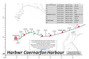
53° 07’.31 N 004°23’.89 W
David John O’Neill
Harbwr Feistr Caernarfon Harbour Master
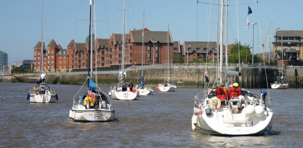
Sailing in Company since 1928


Aid to Navigation Aber Menai Point is on station and is now demonstrating it’s appropriate light characteristic.
53° 07’.31 N 004°23’.89 W
David John O’Neill
Harbwr Feistr Caernarfon Harbour Master
Aid to Navigation Aber Menai Point is on station but not showing it’s appropriate lights. The land marks position is 53° 07’.31 N 004°23’.89 W
Mariners are advised to navigate with caution in this area.
David John O’Neill
Harbwr Feistr Caernarfon Harbour Master
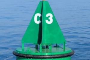
Aid to navigation Starboard No C3 QG is on its appropriate station
53° 07’.31 N 004°23’.89 W
David John O’Neill
Harbwr Feistr Caernarfon Harbour Master
All mariners are advised that Conwy Harbour LNtM No 7 of 2026 is cancelled.
The wreck of the Vanguard II has been recovered.
Matthew Forbes
MSc LLB (hons) BSc AFNI
Conwy Harbour Master
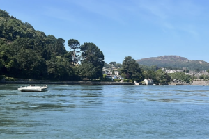
Open Water Swim Event – Saturday, 18th July, 2026.
An Open Water Swim Event will commence at 13:50 from Menai Slipway and finish at Y Felinheli – ETA 15:50. Swimmers will be keeping to the Anglesey side and will cross over at Plas Newydd – ETA 15.20
They will be accompanied by safety kayakers and powerboats.
Please exercise caution when navigating in the vicinity of the event.
David John O’Neill
Harbwr Feistr Caernarfon Harbour Master
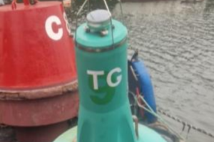
Aid to navigation Starboard “Traeth Gwyllt” Fl(2)G.10s is on its new station.
53° 09.24 N 004°16.06 W
David John O’Neill
Harbwr Feistr Caernarfon Harbour Master
All mariners are advised that a pontoon and mooring have dragged to the south side of Conwy Bridge. The position is latitude 53° 16.7’ north, longitude 003° 49.1’ west. The pontoon should be passed at minimum distance of 50 metres as a submerged mooring buoy is also present. The pontoon is unlit.
A cancelation notice will be issued when the obstructions are removed.
Matthew Forbes
MSc LLB (hons) BSc AFNI
Conwy Harbour Master
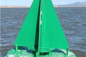
Aid to navigation Starboard No C3 QG is on its appropriate station and is now lit.
53° 07’.23 N 004°23’.88 W
Mariners are advised that this notice herby cancels Notice 09/26
David John O’Neill
Harbwr Feistr Caernarfon Harbour Master
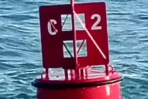
Aid to navigation Port No C2 Fl.R 10s is on its appropriate station and now lit.
53° 07’.17 N 004°24’.32 W
Mariners are advised that this notice herby cancels Notice 07/26
David John O’Neill
Harbwr Feistr Caernarfon Harbour Master