Caernarfon Notice to Mariners 08/2023

Aid to navigation Llanddwyn Island “North East Rock” South Cardinal, Y.B is off station.
53°08.04′ N 004°24.47′ W
Mariners are advised to exercise extreme caution in this area.
Sailing in Company since 1928

Aid to navigation Llanddwyn Island “North East Rock” South Cardinal, Y.B is off station.
53°08.04′ N 004°24.47′ W
Mariners are advised to exercise extreme caution in this area.
All mariners are advised that Local Notice to Mariners 04/2023 is hereby cancelled.
Matthew Forbes
MSc LLB (hons) BSc AFNI
Conwy Harbour Master

The Caernarfon Harbour Master has published the latest bar buoy positions:
| Buoy | Latitude | Longitude | Lights | |
|---|---|---|---|---|
| LLANDDWYN ISLANDSW ROCK BUOYS CARDINAL | N02791 | 53ᵒ 07’.795 N | 004ᵒ25’.005 W | Unlit |
| LLANDDWYN ISLANDE ROCK BUOYS CARDINAL | N2792 | 53ᵒ 08’.040 N | 004ᵒ24’.470 W | Unlit |
| SAFE WATER MARK | N17963 | 53ᵒ 07’.149 N | 004ᵒ25’.182 W | L Fl.10s |
| C 1 STARBOARD | N02793 | 53ᵒ 06’.95 N | 004ᵒ24’.51 W | Fl.G.5s |
| C 2 PORT | N02794 | 53ᵒ 07’.02 N | 004ᵒ24’.09 W | Fl.R.10s |
| C 3 STARBOARD | N02795 | 53ᵒ 07’.03 N | 004ᵒ 23’.72 W | Q.G |
| C 4 PORT | N02796 | 53ᵒ 07’.15 N | 004ᵒ23’.03 W | Q.R |
| C 5 STARBOARD | N02797 | 53ᵒ 07’.14 N | 004ᵒ23’.37 W | Fl.G(2).5s |
| C 6 PORT | N02798 | 53ᵒ 07’.16 N | 004ᵒ21’.91W | Fl.R.5s |
| MUSSEL BANK | N02799 | 53ᵒ 07’.22 N | 004ᵒ20’.93 W | Fl.R(2).5s |
| C 8 PORT | N02801 | 53ᵒ 07’.68 N | 004ᵒ19’.33 W | Fl.R.3s |
| C 10 PORT | N02802 | 53ᵒ 07’.964 N | 004ᵒ18’.249 W | Q.R |
| C 7 STARBOARD | N02803 | 53ᵒ 08’.18 N | 004ᵒ18’.13 W | Q.G |
| C 12 PORT | N02804 | 53ᵒ 08’.50 N | 004ᵒ17’.38 W | Fl(2)R.10s |
| C 9 STARBOARD | N02805 | 53ᵒ 08’.55 N | 004ᵒ16’.92 W | Fl.G.2s |
| CHANGE BUOYS CARDINAL | N02834 | 53ᵒ 08’.81 N | 004ᵒ16’.74 W | VQ(6)+LFl 10s |
| SEIONT RIVERBIFURCATION | N14410 | 53ᵒ 08’.51 N | 004ᵒ16’.75 W | Unlit |
| TRAETH GWYLLTSTARBOARD | N10125 | 53ᵒ 09’.23 N | 004ᵒ16’.12 W | Fl(2)G.10s |
| C 13 STARBOARD | N02811 | 53ᵒ 09’.54 N | 004ᵒ15’.90 W | Fl(4)G.10s |
| C 11 STARBOARD | N02812 | 53ᵒ 09’.88 N | 004ᵒ15’.63 W | Fl(2)G.5s |
| C 14 PORT | N02813 | 53ᵒ 10’.23 N | 004ᵒ15’.41 W | Fl.R.5s |
| C 9 STARBOARDPORT DINORWIC | N08507 | 53ᵒ 10.65 N | 004ᵒ13’.95 W | FL(3)G.10s |
All mariners are advised that navigation mark C13 in the Conwy Harbour approach channel is temporarily unlit. A cancelation notice will be issued once the issue is rectified.
Matthew Forbes
MSc LLB (hons) BSc AFNI
Conwy Harbour Master
Update with regards to Local Notice to Mariners 01/2023.
The Beacons Pontoon is off station for repairs. A lit isolated danger mark has now been positioned in co-ordinates :- 53°17.64N 003°50.35W
Matthew Forbes
MSc LLB (hons) BSc AFNI
Conwy Harbour Master
All mariners are advised that the Beacons Pontoon is off station for repairs. The access gantry is laid on the riverbed and accordingly mariners should not navigate within the Beacons piles due to the underwater obstruction. A further notice will be issued once the pontoon is back on station. The present downtime is estimated at up to four weeks.
Matthew Forbes
MSc LLB (hons) BSc AFNI
Conwy Harbour Master

All Mariners are advised that under Marine Licence DML 1833v3 dredging at Conwy Marina will commence on 3rd January 2023. A further notice will be issued when the temporary special mark marking the end of the dredging discharge pipe is laid.
Matthew Forbes
MSc LLB (hons) BSc AFNI
Conwy Harbour Master

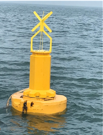
We hereby notify mariners of a small change in position of the four special marks at the corners of the experimental mussel farm site in Conwy Bay. Each special mark is of yellow, St Andrews Cross type (2m), indicating a marine farm/aquaculture. The NE and SW marks are fitted with a yellow light, set to a 5 second flash sequence.
The new positions are:
| DDM WGS84 | ||
| NW | N 53 18.643 | W 3 59.523 |
| NE | N 53 18.688 | W 3 59.282 |
| SE | N 53 18.543 | W 3 59.205 |
| SW | N 53 18.497 | W 3 59.446 |
The experimental site is in an area of open water in Conwy Bay (see figure 1), just to the East of Dutchman bank. It is marked on admiralty charts for aquaculture research.
Within the site are six 150m polysteel longlines. Depending on production state, they may be buoyed with pencil floats, or they may be invisible; using near-surface submersible floats.
Please be cautious when navigating near to the site
Mariners are requested to give the installation and the buoys by which it is marked a wide berth. The buoys have drogues attached that trail beneath them in the water.
For more information, contact Julie Webb on 01248 388140/07966546915 or Ben Winterbourn on 01248 388784/07732438894 or Conwy Harbour Master, Matthew Forbes: 01492 596253.

All Mariners are advised that Local Notice to Mariners 2022 numbers 13, 14, 17 and 18 are hereby cancelled.
Matthew Forbes
MSc LLB (hons) BSc MNI
Conwy Harbour Master

Aid to Navigation Temporary Wreck Buoy marking the Grampian Castle Fl(4) Y10s is not on station. 53° 07’.27 N 004° 22’.94 W
The Wrecks charted position is 53° 07’.30 N 004° 22’.98 W
The Aid to navigation has been temporarily discontinued for the winter.
David John O’Neill
Harbwr Feistr Caernarfon Harbour Master